
Revolutionizing Industries with Advanced Automated Mapping Systems
- Tanmay Chauhan
- Jun 24
- 4 min read

In today’s fast-paced world, industries are constantly seeking innovative ways to enhance efficiency and productivity. One such advancement that has gained significant traction is the exploration of advanced mapping systems. These systems have the power to transform industries by providing accurate, real-time data that drives decision-making processes. From agriculture to urban planning, advanced mapping systems are changing the way businesses operate and make strategic choices.

Understanding Advanced Mapping Systems
Advanced mapping systems are designed to capture, analyze, and present geographical data in a way that is easily interpretable. They utilize various technologies including Geographic Information Systems (GIS), satellite imagery, and aerial drones to create detailed maps that can be used for numerous purposes.
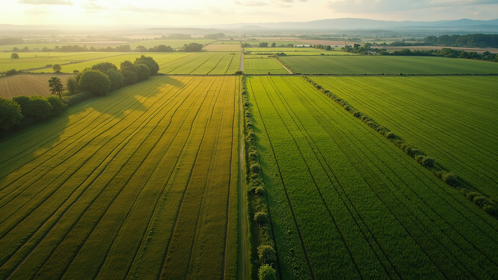
For example, in agriculture, farmers can use these systems to monitor crop health, plan irrigation schedules, and maximize yields. By incorporating satellite data, farmers can obtain precise information about soil conditions, moisture levels, and the presence of pests. This not only leads to increased productivity but also promotes sustainable farming practices.
In urban planning, city officials rely on advanced mapping systems to visualize infrastructure development, manage transportation networks, and assess land usage. The ability to map out urban environments accurately helps in making informed decisions about zoning and resource allocation.
The Role of Mapping in Industry Transformation
The introduction of advanced mapping systems has reshaped various industries, proving that mapping is far more than just a tool for navigation.
In the retail sector, for instance, businesses use heat maps to analyze customer behavior within stores. This technology allows retailers to understand which areas attract the most foot traffic and which products capture attention. As a result, they can optimize store layouts, improve product placement, and ultimately increase sales.
Similarly, logistics companies leverage mapping systems for route optimization, tracking delivery vehicles, and managing supply chains. By analyzing traffic data and delivery patterns, companies can reduce transit times and fuel costs. A study from the American Transportation Research Institute revealed that efficient route planning can save logistics companies up to 10% in fuel expenses annually.

What is the Difference Between Mapping Software and Automated Mapping?
When exploring the realm of advanced mapping technologies, it's essential to distinguish between mapping software and automated mapping. Mapping software typically refers to applications that assist users in creating, editing, and viewing maps. While these tools can be beneficial, they often require significant manual input and user skill.
On the other hand, automated mapping systems take it a step further. They automate the collection and analysis of geographical data, reducing the need for human intervention. This means that users can receive real-time insights without spending hours creating maps from scratch. The efficiency gained through automation allows businesses to focus more on strategic activities rather than operational tasks.
For example, in the field of environmental monitoring, automated mapping systems can track changes in ecosystems over time. This allows researchers to study patterns in deforestation or water quality without needing to venture into the field constantly.
Industry Applications of Advanced Mapping Systems
Healthcare: Hospitals and health organizations are employing advanced mapping systems to track disease outbreaks and allocate resources effectively. By analyzing geographical patterns of infections, healthcare providers can improve response times and implement preventive measures more successfully.
Mining: The mining industry relies on advanced mapping for resource identification and site analysis. Advanced mapping systems help in determining the best locations for extraction and in ensuring compliance with environmental regulations.
Insurance: Insurance companies utilize mapping systems for risk assessment when underwriting policies. By assessing geographical risks, they can offer more accurate premiums and ensure that they are financially protected against potential disasters.
Telecommunications: Telecommunication companies use advanced mapping to plan infrastructure installations and optimize signal coverage. This enhances customer experience as it helps in providing seamless connectivity in urban and rural areas alike.
The Evolution and Future of Mapping Technologies
The evolution of mapping technologies has been rapid, moving from static maps to interactive, real-time systems. With the advent of artificial intelligence and machine learning, advanced mapping systems are becoming smarter and more intuitive. Future advancements may allow for predictive modeling, where maps can foresee changes and adapt accordingly.
For instance, as cities grow and change, the ability to model future urban developments through mapping system simulations will be invaluable. This could lead to more sustainable city planning, where infrastructure evolves in harmony with population growth.
Moreover, the integration of augmented reality (AR) with mapping systems could revolutionize how users interact with maps. Imagine walking through a city with a mapping app that overlays real-time data, guiding you to the nearest restaurant while showcasing historical facts about the surrounding buildings.
Practical Recommendations for Adopting Advanced Mapping Systems
As industries explore the potential of advanced mapping systems, there are a few practical steps to consider:
Identify Needs: Assess your organization's specific needs. Determine which functions could benefit from advanced mapping, including logistics, marketing, or resource allocation.
Invest in Training: Ensure that your team is adequately trained to utilize these systems. Offer workshops or training sessions to enhance their skills in interpreting mapping data.
Choose the Right Technology: Not all mapping systems are created equal. Research and select a system that best fits your requirements. Factors to consider include ease of use, technical support, and integration capabilities.
Commit to Continuous Improvement: Mapping technology is evolving daily. Stay updated with new tools and techniques, and be open to adopting innovations that could benefit your operations.
In the era of rapid technological advancement, incorporating advanced mapping systems into your organization can be a game-changer. The insights provided through accurate geographical data not only enhance operational efficiency but also foster informed decision-making.
By exploring how these systems can serve your specific industry needs, you will likely find opportunities to innovate and outperform competitors. The mapping journey has just begun—are you ready to navigate your way to success?
